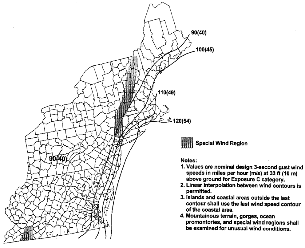
Wind Map of USA and Regional Data United States
Basic Wind Speed Data Chart USA and regional wind data.
Related:
- Wind Loading Analysis Buildings with Clad Components V-Roof
- Wind Loading Analysis Main Wind-Force Resisting System V-Roof
Figure 6-1
(Click on image to enlarge)
Western Gulf of Mexico Hurricane Coastline
Figure 6-2
(Click on image to enlarge)
Eastern Gulf & Southeastern U.S. Hurricane Coastline
Figure 6-3
(Click on image to enlarge)
Mid & Northern Atlanta Hurricane Coastline
Figure 6-4
(Click on image to enlarge)


